The Stages 2027

TRT classic

The Original. The 5 most beautiful trails in the region.
15 - 27 km & 1100 - 1700 hm

1. Thomas Penz Höhenweg classic

16,9 km

1081 m

1081 m

A magnificent tour high above the Kaunertal.

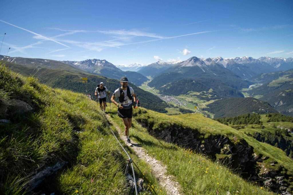
From Feichten, the route follows trails just above the valley floor on a slight incline to Vergötschen until you reach a forest path. The trail now climbs steadily up to the edge of the forest, where you take a sharp left onto the Thomas Penz Weg. The fantastic panorama of the Kaunertal now opens up before you. The narrow but easy trails continue into the valley. However, you don’t have to climb many metres in altitude, as the ascents are usually only short and you get into a real flow. Shortly before the real downhill begins, there is a small, slightly exposed section, which is perfectly defused with a wire rope. You now head back down into the valley via the many hairpin bends and the last few kilometres are flat back to Feichten.

V=Refreshment station

2. Anton Renk Trail classic

21,6 km

1477 m

1477 m

A long and challenging trail running circuit that offers an unforgettable experience with the Anton Renk waterfall.

The route starts in Ried and climbs steeply right at the beginning to Fendels and on to the Fendler Alm. After a good 1100 metres, the Fendler Alm is ideal for a small refreshment stop. Now it becomes a lot flatter and shortly before the Zirmesköpfle the trail follows the mountainside to the Anton Renk hut. Here you have a permanent view of the waterfall. Once you reach the rustic self-catering hut, it’s all downhill. At the Stalanzer Alm, you can enjoy a refreshment stop and the waterfall before alternating between trails and forest paths back to Ried to the finish.

V=Refreshment station

3. Samnaun Trail classic

14,4 km

1245 m

1245 m

Stunning trail tour with a pleasant run-in and run-out.

Very panoramic sections at the red Seeli and technically easy, beautiful trails. From Samnaun, the route starts off at a leisurely pace along the Märchenweg, soon branching off to the left and following the beautiful trails into the valley. Now it gets a little steeper and you reach the 2659m high Stammer Joch. Here you have a great view of the almost 3300m high Muttler, the highest mountain in the Samnaun group. Follow the trail down into the valley and then walk back up the other side towards Muttler. At just under 2600m, take a sharp left and follow the trail back onto a forest path and back to the finish line.

CP=Checkpoint

Trailrunning Nauders - Nauderer Höhenweg

4. Nauderer Höhenweg classic

26,5 km

1608 m

1608 m

A trail run in a class of its own!

From Nauders, the trail leads through the sparse mountain forest and meadows via Parditsch Bazahlerkopf. Now the trail climbs steeply and you should take your time, especially in July, to enjoy the flower-filled mountain meadows. The many edelweiss are particularly striking here, especially on the steeper terrain! (Be careful not to pick them, the edelweiss is a protected species). After this steep section, you soon reach the large summit cross on the escape wall. The route now continues flat and finally climbs briefly to the Sadererjoch. From here, continue to the Labaunalm and the somewhat steeper ascent to the Labauner Köpfl. Now it’s a gentle up and down for several kilometres. Then it’s just through the sparse mountain forest back to Nauders to the finish.

V=Refreshment station

5. Reschensee Trail classic

18,8 km

1476 m

1476 m

Finally, the highlight of the tour: a very beautiful but challenging alpine loop with spectacular views of Lake Reschen and the Ortler Group.

The starting point is at the Schönebenbahn mountain station. From there, a scenic trail with views of Lake Reschen leads to the Haideralm. The route then follows a loop toward Seeköpfl to Grünsee before heading back and continuing with the ascent to the Elferspitze, which is easily manageable with good footwork. The trail descends over simple boulder terrain via the Zwölferkopf to the finish.

V=Refreshment station

The Stages 2027

TRT shortcut

Like the original. Just shorter & more compact.
12 - 20 km & 900 - 1100 hm

1. Thomas Penz Höhenweg shortcut

12,9 km

909 m

909 m

The little brother of the Thomas Penz Höhenweg classic.

From Feichten, the route follows trails just above the valley floor on a slight incline to Vergötschen until you reach a forest path. The trail now climbs steadily up to the edge of the forest, where you take a sharp left onto the Thomas Penz Weg. The fantastic panorama of the Kaunertal now opens up before you. The narrow but easy trails continue into the valley. Then turn left onto the shortcut and follow a steep path downwards back into the valley and to the finish.

V=Refreshment station

2. Anton Renk Trail shortcut

18,4 km

978 m

1477 m

The nephew of the Anton Renk Trail Classic, which also offers an unforgettable experience with the Anton Renk Waterfall.

The race starts with all participants in Ried, but then you immediately take the cable car to Fendels, saving you 3 km and 500 hm. After 4 km, you reach V1, the Fendler Alm. Now it becomes a lot flatter and shortly before the Zirmesköpfle the trail follows the mountainside to the Anton Renk hut. Here you have a permanent view of the waterfall. Once you reach the rustic self-catering hut, it’s all downhill. At the Stalanzer Alm, you can enjoy a refreshment stop and the waterfall before alternating between trails and forest paths back to Ried to the finish.

V=Refreshment station

3. Samnaun Trail shortcut

12,2 km

910 m

910 m

The younger cousin of the Samnaun Trail Classic.

Very panoramic sections at the red Seeli and technically easy, beautiful trails. From Samnaun, the route starts off at a leisurely pace along the Märchenweg, soon branching off to the left and following the beautiful trails into the valley. Now it gets a little steeper and you reach the 2659m high Stammer Joch. Here you have a great view of the almost 3300m high Muttler, the highest mountain in the Samnaun group. Follow the trail down into the valley and follow the Maisas-river to the finish.

CP=Checkpoint

4. Nauderer Höhenweg shortcut

20,1 km

1109 m

1109 m

The little cousin of the Nauderer Höhenweg Classic!

From Nauders, the trail leads through the sparse mountain forest and meadows via Parditsch Bazahlerkopf. Now the trail climbs steeply and you should take your time, especially in July, to enjoy the flower-filled mountain meadows. Here, you turn off the original route to the right and take the shortcut to the Labaunalm, which saves 6.4 km and 500 hm. From there, you follow the slightly steeper path up to the Laubauner Köpfl. Then it’s just through the sparse mountain forest back to Nauders to the finish.

V=Refreshment station
5. Reschensee Trail shortcut

17,1 km

964 m

964 m

A grand shortcut finale with a magnificent view of Lake Reschen and the Ortler Group.

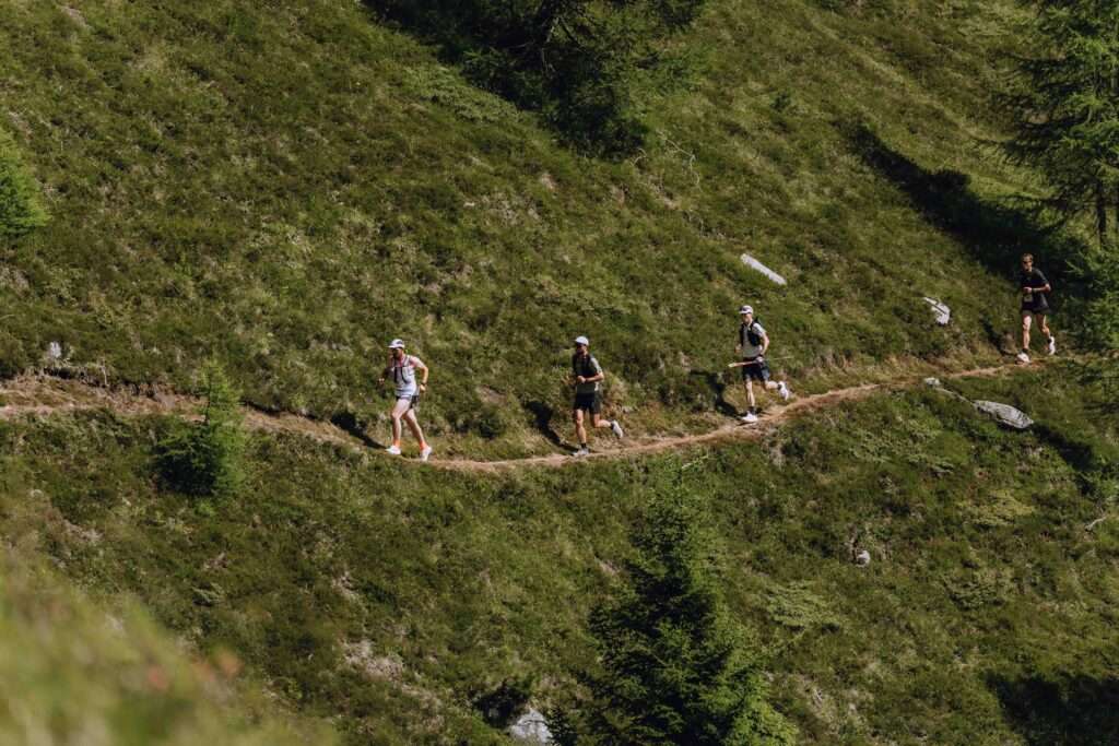
The starting point is at the Schönebenbahn mountain station. From there, a scenic trail with views of Lake Reschen leads to the Haideralm. The route then follows a loop toward Seeköpfl to Grünsee, offering repeated stunning views down into the valley toward Lake Haidersee, before returning along the same route back to the finish line.

V=Refreshment station